The catchment of the Mitta Mitta river stretches from the Victorian Alpine country down to the Murray River at Lake Hume. The elevation changes from nearly 2000m at Mt Bogong down to around 200m near Tallangatta. It therefore takes in a number of bioregions and landscapes. The region has a rainfall that varies from around 700 mm in the lower valley to 2,400 mm at Mount Bogong which experiences snow every year. Surface water and groundwater systems in the catchment range from being highly connected to permanently disconnected. There are alluvial aquifers along the Mitta Mitta River, especially in its lower reaches and on the floodplain, where the ancestral Murray and Mitta Mitta rivers flowed. Most upland streams receive flow from fractured rock aquifers.
Upper Mitta & High Country
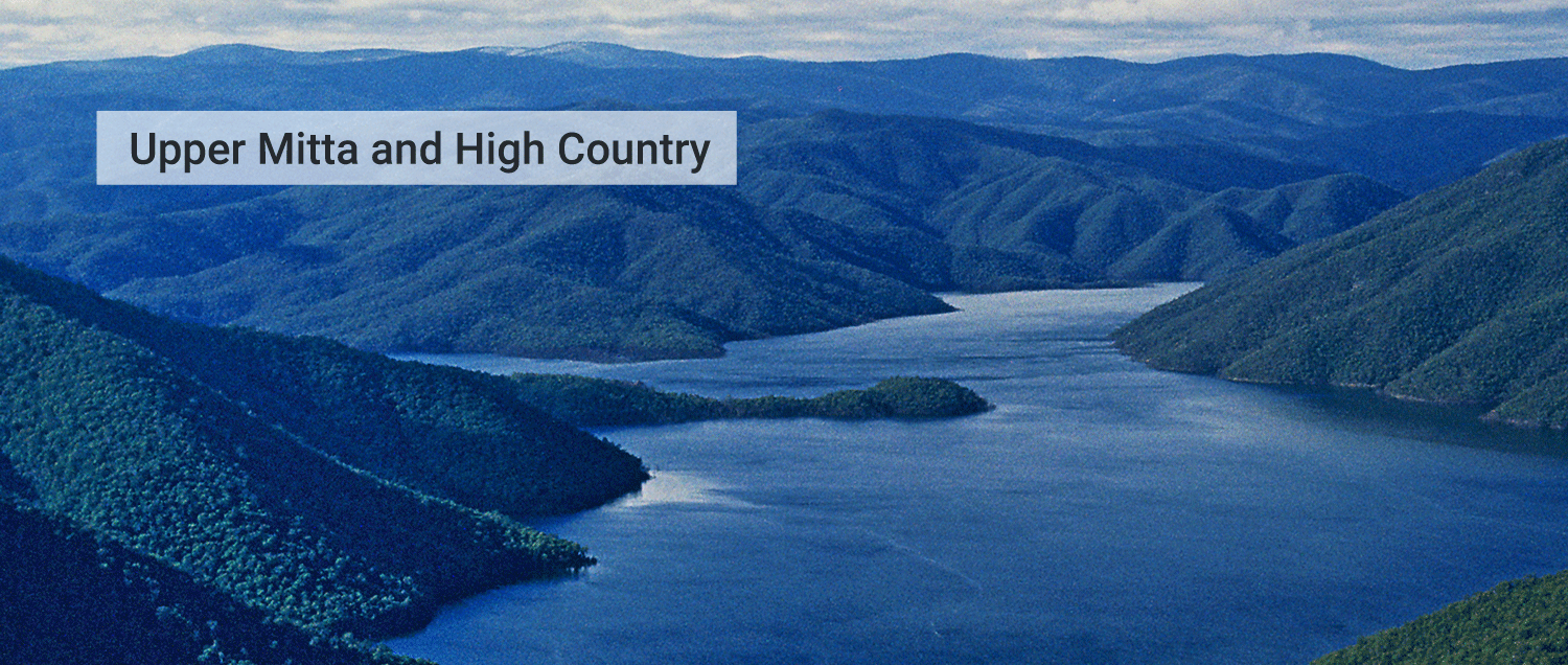
The upper reaches of the Mitta Mitta River catchment are in the alpine landscapes of the Great Dividing Range, east of Falls Creek. Close to the Kiewa River headwaters, the Mitta River is formed by 4 tributaries, the Big River, Bundara and Cobungra rivers, and Livingstone Creek. The Big River is the main tributary, rising on the slopes of Mount Bogong and merging with the Cobungra River at Anglers Rest to form the Mitta Mitta River. These high landscapes are dominated by snow gum woodlands and alpine heaths of the Australian Alps Bioregion. The river heads north-east through the mountains and the alpine landscapes give way to the tall forested ranges and valleys of the South East Highlands Bioregion. The Mitta Mitta is joined by the Livingstone Creek just west of Benambra, and then flows northwards to its confluence with the Morass Creek and smaller tributaries at the southern end of Lake Dartmouth.
The Mitta Mitta River upstream of Dartmouth Dam and the Big River are declared heritage rivers by the Victorian State Government. The Dartmouth Dam and the Mitta Mitta River are 2 of 8 nationally important wetlands in the region. Much of the upper Mitta Mitta catchment is pristine and lies within the Alpine National Park.
Mitta Valley
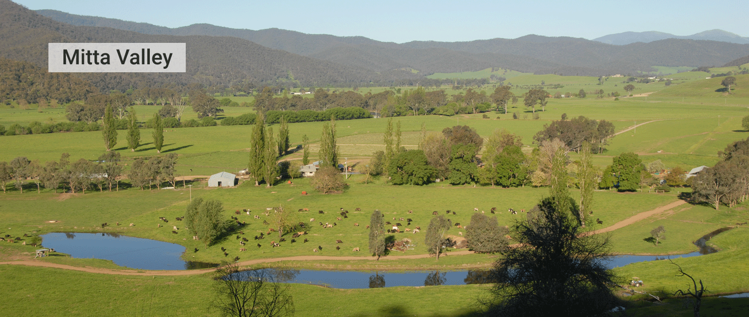
The Dartmouth Dam signifies the transition from the upper to the lower Mitta Mitta River system. Below the dam wall, the river flows in a north-westerly direction through a rocky gorge and descends from the highlands towards the Northern Inland Slopes bioregion. It is joined by the Watchingorra Creek and then the Snowy Creek at the township of Mitta Mitta. Turning northwards, the Mitta Mitta River meanders northward with extensively cleared floodplains widening out and mountains changing to rolling hills. The floodplain landscapes are agricultural with pastures with scattered trees but were probably open forests and woodlands prior to European settlements. Continuing its way past Eskdale the river eventually flows into the southern arm of the Hume Dam near Tallangatta, east of Wodonga.
The Dartmouth Dam has strongly affected the hydrology of the lower river but there are good floodplain, billabong and wetland habitats downstream of Tallandoon on the lower reaches of the river. The lower landscapes provide habitat for high priority threatened native fish such as Macquarie perch, Murray cod, golden perch and flat-headed galaxias. Other high priority species found along the Mitta Mitta system include spotted tree frogs and the alpine spiny crayfish, in the upper Snowy Creek catchment.
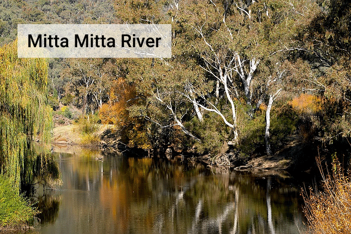
Significant vegetation can be found along most of the river system in stands or remnant patches, providing an important habitat between waterways and larger areas of vegetation, including healthy stands of river red gum. Good riparian vegetation in the upper reaches of the Mitta Mitta provides habitats for animal species and native fish are present but with restricted diversity due to the water regulation.